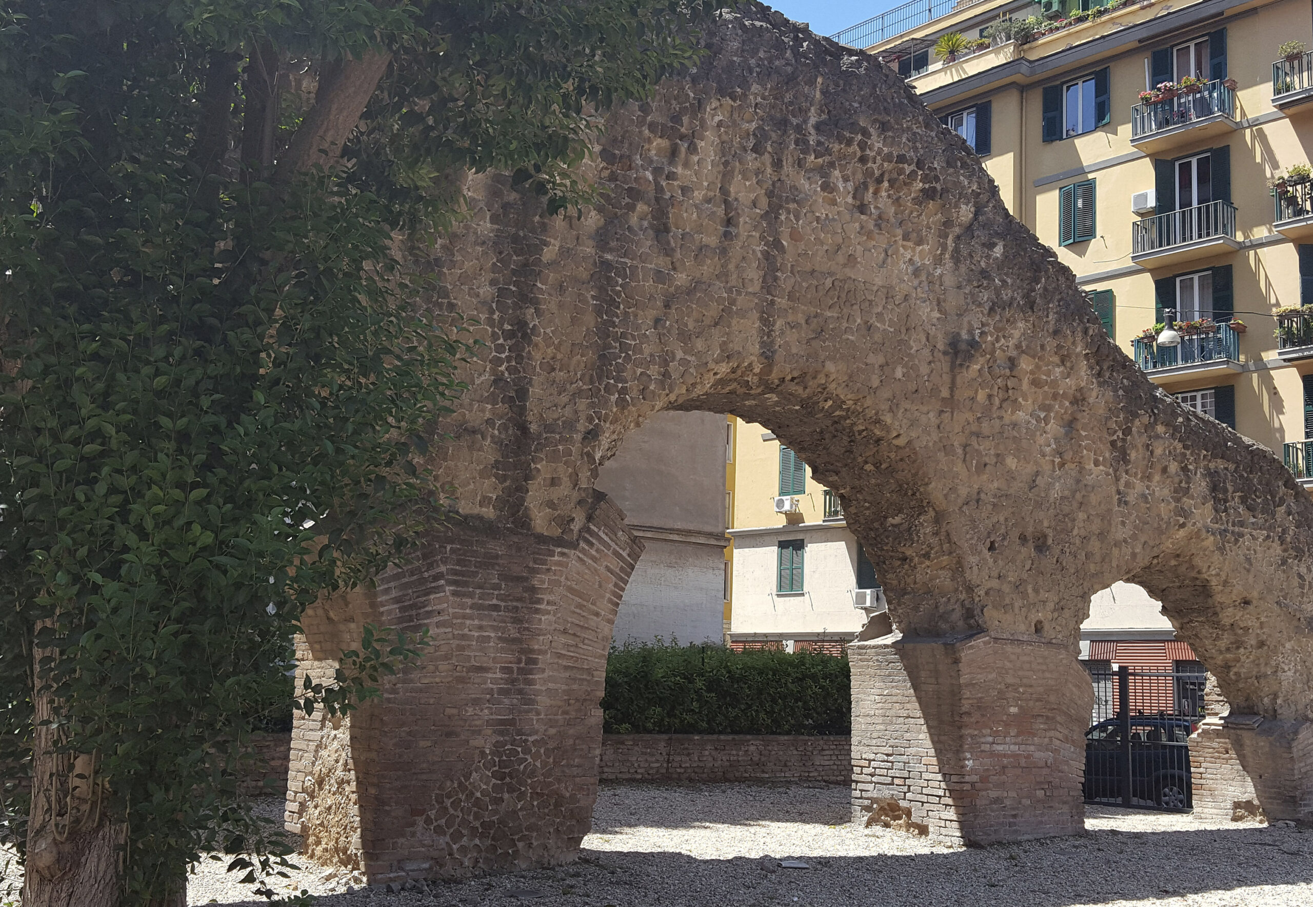
Aventine Hill is one of the seven hills of Rome. It is a historically significant area that played an important role in the development of the myth of Rome. The hill is 46 meters above sea level, located to the east of the Tiber River, and is separated from the Palatine Hill by the Circus Maximus.
The Aventine, according to Roman tradition, was not part of Rome’s original founding and was outside the city’s ancient sacred boundaries (pomerium). According to legend, Romulus established the first pomerium, which was limited to the base of the Palatine hill. However, as the Republic grew, the pomerium was extended multiple times, finally encircling many of the main hills.
Aventine Hill has played an essential part in the urban evolution of Rome, with evidence of settlements reaching back to the eighth century BCE. The hill’s strategic and defensive importance stemmed from its location overlooking the Tiber River and the city. Aventine Hill was incorporated into the Roman Republic’s urban planning in the fifth century BCE and became part of the city’s fortifications. The hill was once uninhabited, but became populated as the city grew, becoming a heavily populated area during the Republic. During the Imperial period, the hill became a residential area for the elite, with villas and gardens built on its slopes, and it became home to emperors Hadrian and Trajan, as well as some of Rome’s most powerful families such as the Claudii, the Fulvii, and the Cincinnati. When viewed from the banks of Tiber River, some remains of Imperial period structures are still visible.
The Temple of Diana was built in the second century CE and is located on Aventine Hill’s southeastern slope. The temple is devoted to the Roman goddess Diana, who was associated with hunting, the moon, and childbirth.
During the Christian period, the Aventine Hill became home to some of Rome’s most impressive churches, including the Basilica di Santa Sabina and the Basilica di Santa Prisca. The former is one of Rome’s oldest and most prominent churches, dating back to the fifth century CE. The latter is famous for its stunning frescoes depicting episodes from Saint Prisca’s life.
The churches of Santa Saba and Santa Balbina, and the Caracalla baths are also located on the southeast side of the hill on Viale Aventino. The baths were built between 211 and 216 CE and were the largest and most impressive public baths in ancient Rome. From the Etruscan fortification to the Roman Republic and beyond, the hill has played an important role in the city’s development and remains a popular tourist and historical attraction.
Sources
- Guidoboni, E., & Mancusi, M. (2019). Aventine Hill – Inception, Urban Development, and Cultural Heritage in Rome. International Journal of Architectural Heritage, P902-916.
- Wiseman, T. P. (2018). The Aventine Hill in Rome: a Political History. Cambridge University Press.
- Mettimano, A. (2016). The Aventine Hill and the Ghetto of Rome: Jews, Landlords, and Tenants in the Eighteenth Century. Journal of Modern Italian Studies,, P755-768.
- Coarelli, F. (2007). Rome and environs: an archaeological guide. University of California Press.
- Cullen, J. (2005). A walk in ancient Rome : vivid journey back in time, New York, NY, P42-44
- Heiken, G; Funiciello, R; De Rita, D. (2005). The seven hills of Rome : a geological tour of the eternal city, Princeton : Princeton University Press, P50-58
- Richardson, L. (1992). A new topographical dictionary of ancient Rome. The Johns Hopkins University Press.
The southernmost of the hills of Rome, stretching south-east from the Tiber; it is trapezoidal in shape, with sides that measure, beginning with that towards the river, about 500, 600, 750, 600 metres in length.
Read more:
It rises abruptly from the bank of the river on the north and south-west. Its height near S. Alessio is 46 metres above sea-level. Along the south-east side of this trapezoidal hill is a depression, through which ran the ancient VICUS PORTAE RAUDUSCULANAE (q.v.), followed by the modern Viale di porta S. Paolo, and beyond this depression rises another elevation which gradually sloped off to the Almo beyond the;line of the Aurelian wall. This part of the hill, on which stand the churches of S. Saba and S. Balbina, is sometimes called the pseudo- Aventine (see below), but is usually included under the Aventine. The line of the ‘Servian‘ 1 wall-crossed this eastern elevation south of S. Saba and west of S. Balbina, and thus included a section that was considerably smaller than the trapezoidal hill to the north-west.
Whether Aventinus originally included both these parts of the hill has been the subject of much discussion and cannot be regarded as settled. Ennius (ap. Cic. de Div. i. 107) seems to distinguish sharply between them, while later, in the last century of the republic and early empire, it is clear that the name was ordinarily applied to both (Varro, LL v. 163; Suet. reliq. (Roth) 291; Fest. 276; Plut. Rom. 9). The probability is that the original name of the western section by the Tiber, following the analogy of other similar names, was gradually extended to the part of the eastern hill included within the Servian wall. This inclusion is strengthened by the statements of Dionysius who, in his description of the Aventine, gives its circumference once (iii. 43) as eighteen stadia, and elsewhere (x. 31) as twelve. The latter figure is too small even for the western part, and must be considered as an error; the-former corresponds quite closely to that area enclosed within the line of the Servian wall on both hills, and evidently refers to that. In strictly official language Aventinus may always have remained the designation of the western half only. A fragment of the Acta Arvalia recently found (NS 1914, 473; BC 1914, 37; DAP 2. xii. 37; BCr 1915, 66: in clivo capsar(io) in Aventino maior(i) ), of 240 A.D., indicates clearly that then at any rate Aventinus maior, the main part of the hill, was distinguished from Aventinus minor, the part now called the pseudo-Aventine.
When names were given to the Augustan divisions of the city, the thirteenth was called Aventinus; while the twelfth, comprising the eastern part of the hill, was the Piscina Publica (for a full discussion of this question, see Merlin, L’Aventin dans l’Antiquite, Paris 1906, 5-14, and literature there cited; HJ 149-157).
According to the traditional view (Gilbert ii. 144-257) the Aventine, although it was surrounded by the wall of Servius Tullius, remained outside the pomerium until the time of Claudius, and this exclusion was due to religious scruples connected with the founding of the city (Gell. xiii. 14). Another explanation of this exclusion-is that the hill was not included within any wall until the Servian wall was rebuilt in the fourth century, and therefore was outside the pomerium (CP 1909, 420-432; AJA 1918, 175; TF 117-120); for still other theories, and a resume of the whole discussion, see Merlin, op. cit. 53-68); Beloch, Rom. Gesch. 205-208
The name Aventinus is still unexplained, in spite of the many etymologies offered by Roman antiquarians (Varro, LL v. 45; Liv. i. 3. 9; Fest. 19; Verg. Aen. vii. 657, and Servius, ad loc.; Lydus, de mag. i. 34; Jord. i. 1. 180-183; HJ 151-153; Merlin, op. cit. 26-36). The suggestion that the word represents an ancient Italian, or perhaps Ligurian, settlement may possibly find some support in the use of PAGUS AVENTINENSIS (q.v.). The statement of Festus (148: Murciae deae sacellum erat sub monte Aventino qui antea Murcus vocabatur) is probably false.
According to tradition, the Aventine was public domain until 456 B.C. when, by the lex Icilia, a portion of it was handed over to the plebs for settlement (Dionys. iii. 43, x. 31-32; Liv. iii. 31). It continued to be an essentially plebeian quarter until the empire, when many wealthy Romans built their residences there, but it was always a comparatively unimportant part of the city and contained few monumental structures (for a full description of the topography and monuments of the Aventine, see Merlin, op. cit.;. HJ 149-170; P1. 413-417, 421-422).
This content is brought to you by The American Institute for Roman Culture, a 501(C)3 US Non-Profit Organization.
Please support our mission to aid learning and understanding of ancient Rome through free-to-access content by donating today.
Cite This Page
Cite this page as: Darius Arya, The American Institute for Roman Culture, “Aventinus Mons (Aventine Hill)” Ancient Rome Live. Last modified 06/23/2020. https://ancientromelive.org/aventinus-mons-aventine-hill/
License
Created by The American Institute of Roman Culture, published on 06/23/2020 under the following license: Creative Commons: Attribution-NonCommercial-ShareAlike. This license lets others remix, tweak, and build upon this content non-commercially, as long as they credit the author and license their new creations under the identical terms. Please note that content linked from this page may have different licensing terms.

