The Caelian Hill is one of the seven hills of Rome, situated southeast of the city center. The district is connected to the Palatine Hill from the west to the Servian Wall from the east, and is divided from the Esquiline Hill from the north by Via Labicana, east of the Colosseum. The Caelian Hill was a significant area in ancient Rome and is today recognized for its luxurious residential structures and historic Christian sites.
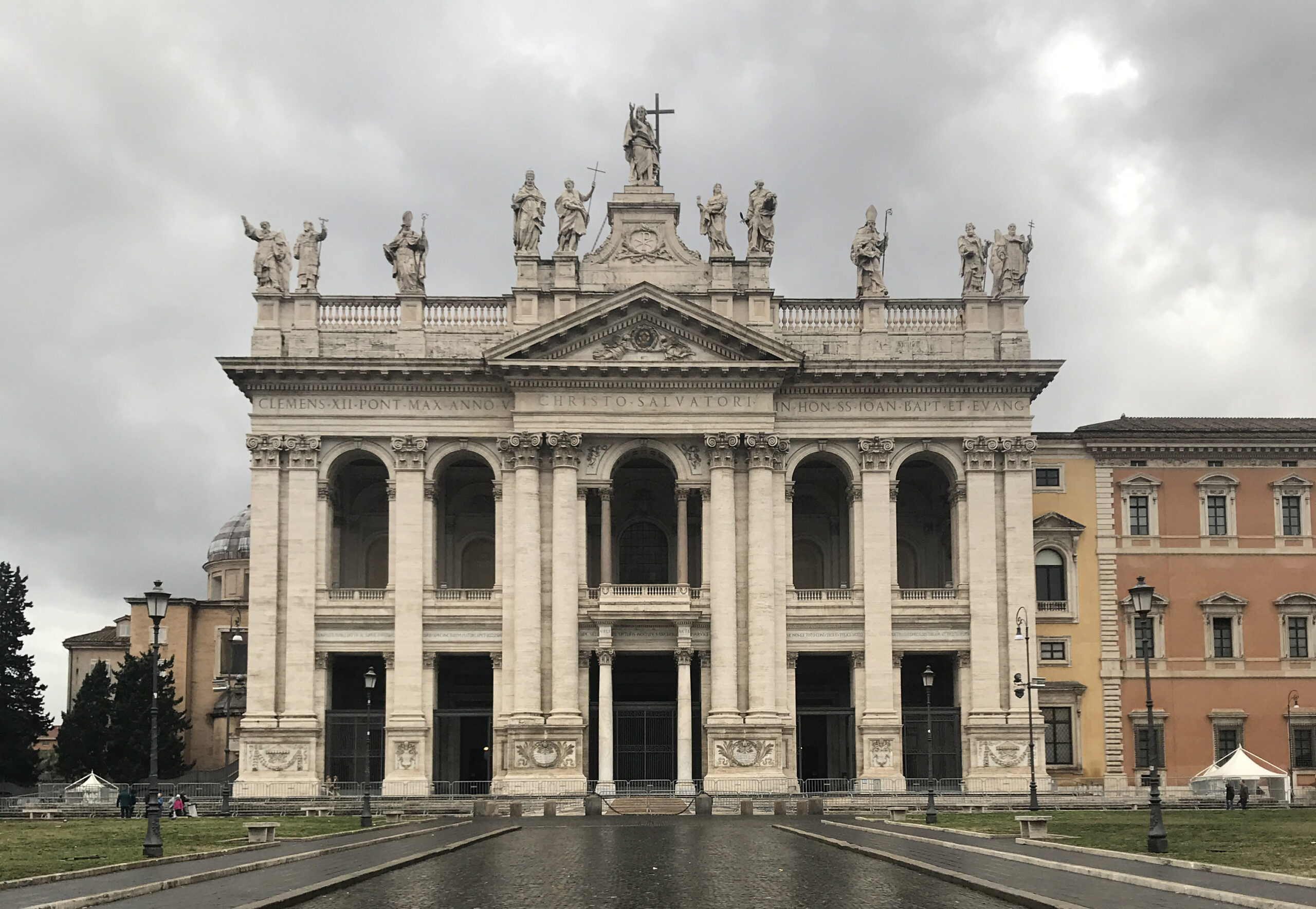
The Caelian Hill may have been named after the large oak groves that covered its surface (Mons Querquetulanus) or after Caelius Vibenna, an Etruscan warrior who is said to have settled on the hill in the ninth century BCE. However, archeological evidence indicates that the hill’s history dates back considerably further. The hill was originally used as a grave site; and was not until the first century BCE during the Late Republic that it became densely populated with elegant houses and estates owned by the city’s wealthiest citizens. Though the hill was mainly a residential district, there is evidence of two large military camps: Castra Peregrinorum and Castra Piora Equitum Singularium. The latter was built by Trajan and then relocated closer to the Lateran by the emperor Septimius Severus. After Maxentius’ death, Constantine built the Basilica di San Giovanni in Laterano in the same area.
The Temple of Claudius was located on the north slope of the Caelian Hill and was built by Emperor Claudius in the early first century CE. It was one of the most important religious sites on the Caelian Hill. Later, in the fourth century CE, the temple was destroyed, and only a few fragments remain today.
The Caelian Hill continued to play an important role in Rome’s cultural and religious life during the medieval and Renaissance periods, and there are still many Christian churches in the modern day neighborhood, including San Clemente, Santi Quattro Coronati, San Stefano Rotondo, Santi Giovanni e Paolo, and San Gregorio Magno. The hill also became a hub for art and architecture; The Villa Celimontana, built by the Mattei family in the 16th century, is a fine example of Renaissance architecture and is surrounded by outstanding gardens with panoramic views of the city.
Sources
Cullen, J. (2005). A walk in ancient Rome : vivid journey back in time, New York, NY, P149-154
Coarelli, Filippo. Rome and Environs: An Archaeological Guide. University of California Press, 2007.
Delia, Diana. “The Roman Caelian: From its Earliest History to the Present Day.” The Journal of Roman Studies, vol. 102, 2012, p1-29.
La Rocca, Eugenio. “The Colosseum and the Caelian Hill.” The Journal of Roman Studies, vol. 105, 2015, p105-130.
Claridge, Amanda. Rome: An Oxford Archaeological Guide. Oxford University Press, 2010, p87-89
Caeliolus or Caeliolum: a part of the Caelian Hill (Varro, LL V.46), appearing as Caeliculus or Caeliculum in Cicero (Reference Latin Library (de har. resp. 32), and probably the Caelius minor of Martial (XII.18.6). The vicus Capitis Africae, the modern via Claudia, seems to have divided the hill into two sections, and the smaller, eastern, section, was presumably the Caeliolus. p88 This is now marked by the church of SS. Quattro Coronati (Gilb. II.32; HJ 223; BC 1914, 353; Eranos, 1923, 55).
Read more:
Caelius Mons: the most south-easterly of the hills of Rome, stretching west from the eastern plateau, from its junction with the Esquiline near the Porta Maggiore, in an irregular tongue about 2 kilometres long and 400 to 500 metres wide. This tongue ends in two points, like promontories, an eastern, probably called Caeliolus (q.v.), where the church of SS. Quattro Coronati now stands, and a western, the site of SS. Giovanni e Paolo. South of the Caelian is the valley traversed by the brook now called the Marrana, part of which was the Vallis Camenarum (q.v.), and on the north it was separated from the Esquiline by the low ground that runs east from the Colosseum. Part of the northern side of the Caelian seems to have been called Sucusa (q.v.) and this was probably just east of the Caeliolus. The height of the Caelian varies considerably, being 45 metres in the Villa Mattei and 54 in the Villa Wolkonsky.
The hill is said to have been called at first Mons Querquetulanus (q.v.), from the oak groves that covered it, but this was perhaps an invention of the antiquarians to explain the Porta Querquetulana (q.v) of the Servian wall. In the reign of Tiberius the senate voted to call the hill Augustus mons, but this name never came into general use. In the Regionary Catalogues the second region of the city is called Caelimontium (q.v.). Caelius itself was explained by the antiquarians as the name given to this hill in consequence of the settlement upon it of Caeles Vibenna and his Etruscan companions who came to the assistance of one of the Roman kings (Varro, LL V.46; Fest. 44, 355; CIL XIII.1668, 1.21). It seems difficult to explain the existence of Caelius mons and Caelius, the name of a well-known plebeian gens, unless there be some connection between the two (Jord. I.1.186‑188.
Tradition varies in ascribing the addition of the Caelius to the city to Romulus (Varro, LL V.46), Tullus Hostilius (Reference: Liv. I.30.33; de vir. ill. 4) Ancus Marcius (Cic. de rep. II.18; , Tarquinius Priscus, and Servius Tullius (or. Claudii, CIL XIII.1668), and is of course without value.
Both Caelius and Sucusa were included in the Septimontium (cf. Fest. 341, 348). The later ‘Servian’ wall, following undoubtedly the original line, crossed the Caelius about 250 metres west of the present church of S. Giovanni in Laterano, and thus included the western half of the hill within the area of the city, a condition that probably went back to the regal period. Whether this hill ever had its own fortifications is still undecided (Ann. d. Inst. 1871, 47; cf. Varro, loc. cit.; Jord. I.1.206; HJ 224).
p89 In Augustus’s division of the city, the Caelian fell into three regions — the western and southern slopes into Region I, the main portion into II, and the extreme eastern part into V. The hill was thickly populated during the republic, and we are told of an apartment house, belonging to Ti. Claudius Centumalus, which the owner was ordered to demolish because it was so high as to cut off the view of the augurs. In 27 A.D. the hill suffered severely from a fire, and afterwards became a favourite place for the residences of the rich, which, with their gardens, seem to have occupied a considerable part of the whole (for the topography and monuments of the Caelian see HJ 220‑255; Pl. 428‑443; RE III.1273‑1275).
This content is brought to you by The American Institute for Roman Culture, a 501(C)3 US Non-Profit Organization.
Please support our mission to aid learning and understanding of ancient Rome through free-to-access content by donating today.
Livy: The Early History of Rome, Books I-V (Penguin Classics) (Bks. 1-5) Paperback – June 25, 2002
The Seven Hills of Rome: A Geological Tour Of The Eternal City Paperback – May 13, 2007
Cite This Page
Cite this page as: Darius Arya, The American Institute for Roman Culture, “Caelius Mons (Caelian Hill)” Ancient Rome Live. Last modified 06/23/2020. https://ancientromelive.org/caelius-mons-caelian-hill/
License
Created by The American Institute of Roman Culture, published on 06/23/2020 under the following license: Creative Commons: Attribution-NonCommercial-ShareAlike. This license lets others remix, tweak, and build upon this content non-commercially, as long as they credit the author and license their new creations under the identical terms. Please note that content linked from this page may have different licensing terms.

